ASTROC Nebulae
Automotive Intelligence
Overview
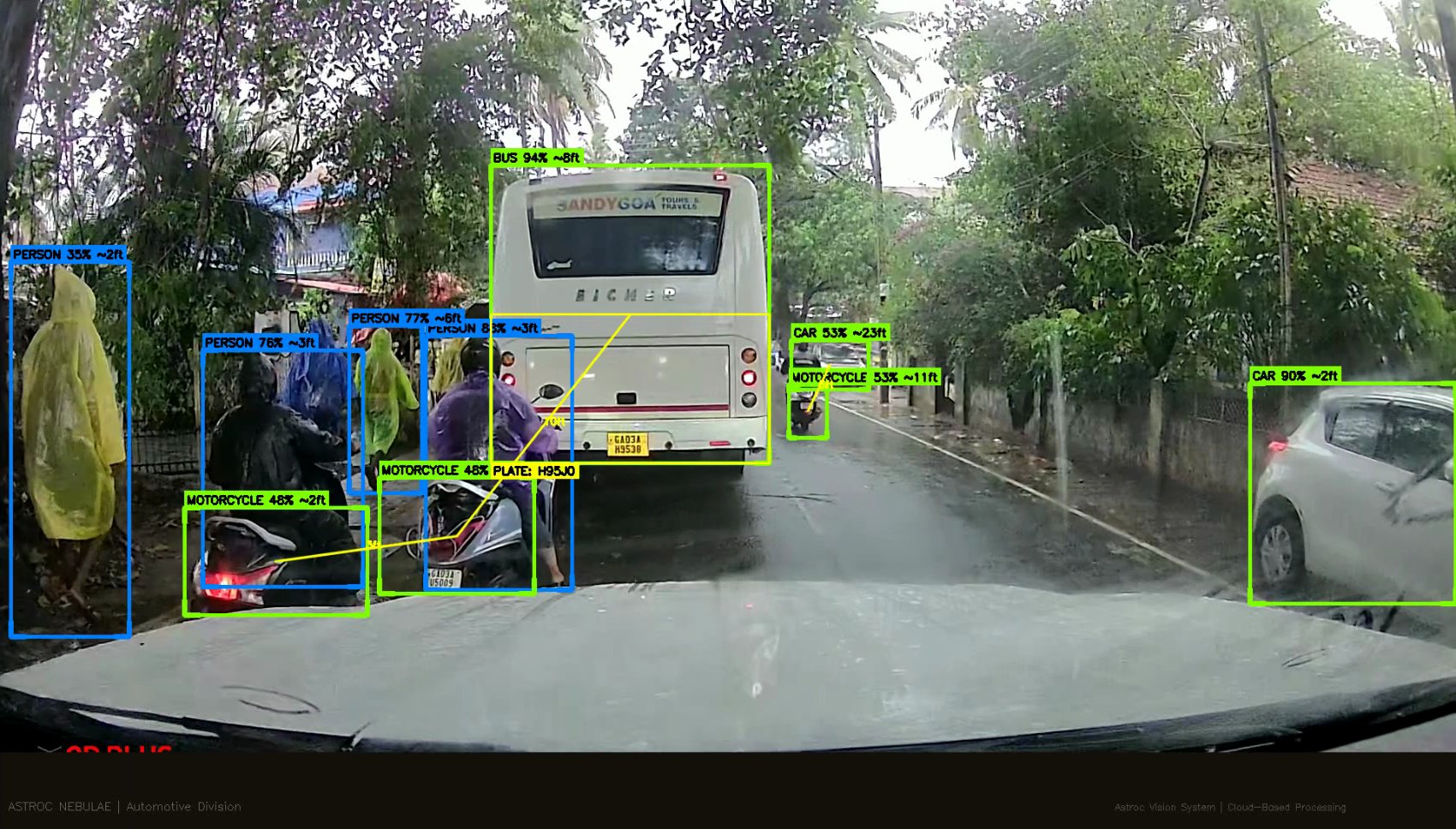
ASTROC Nebulae is our AI-powered automotive intelligence platform that processes dashcam and traffic camera footage to extract comprehensive vehicle, pedestrian, and infrastructure data in real time. The system identifies over 23 distinct object types across every frame, building a complete traffic intelligence picture.
Core Capabilities
The platform runs a multi-stage AI pipeline across incoming video feeds. Vehicle detection and classification runs at 29+ FPS on 1080p streams. Each detected vehicle is tracked across frames, with inter-vehicle distance estimation, lane occupancy analysis, and speed profiling.
Integrated ANPR reads and logs registration plates from both moving and stationary vehicles. The system handles all Indian plate formats including white, yellow, and green plates, with IR-enhanced night mode for 24/7 operation.
Pedestrian and Traffic Analytics
Nebulae tracks pedestrian density in real time, generating alerts when crowd thresholds are crossed. Traffic sign and signal detection identifies regulatory signs, speed limits, and signal states. Display boards and advertising signage are processed through OCR for situational awareness.
Intelligence Output
All detections feed into a unified dashboard showing detection heatmaps, confidence metrics by object class, density timelines, and an event log with automated alerts for high-density zones and traffic anomalies. The system processed 5,500+ detections across 583 frames in initial corridor testing.
Live Platform
Access the live Nebulae dashboard for a demonstration of the system's capabilities on processed corridor footage.
Launch Nebulae Dashboard ↗