top of page

Aerial Services

Mission Planning and data acquisition 

9+ States Covered
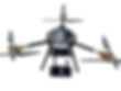
Drone-as-a-Service (DaaS)
​​

Astroc As Tech offers precision Drone-as-a-Service solutions for modern

agriculture—empowering farmers with affordable, efficient, and data-driven

aerial spraying and mapping

.

Coverage & Impact:

  •  50,000+ acres serviced

  •  9+ states across India

  •  20,000+ farmers benefited

  • 30% avg. input savings, up to 40% yield boost

Core Offerings:
• Precision drone spraying
• Field mapping & analytics
• Terrain-adaptive UAVs
• Trained pilot workforce
• OEM-grade reliability

Driving rural transformation—one flight at a time.

Aerial Photo and Videography

Rentals of video drones for wedding, real estate and aerial videography services for promotion of properties.

GIS Mapping Data Acquisition

Our Mapping and Survey Grade drones are equipped with state-of-the-art mapping sensors with 3 cm/px precision mapping capabilities. Our Survey ready drones are provided as DAAS for data acquisition.

471DCE9A-CCF6-4153-A8A3-C892808ADCA1.JPG

Aerial Surveillance 

Aerial Surveillance with actionable intelligence with pattern recognition and tracking systems to enable autonomy on surveillance operations 

IMG_5793.PNG

Critical Infra and Asset Inspection Services 

Critical Infra and Asset Inspection services for predictive maintenance. Solar farms, wind farms, power grids, highway and railway related inspections. 

Y6FRONT (1).jpg

Payload Drones for Delivery

Our heavy Payload Delivery Drones are capable of medical package delivery and cargo delivery drones in the form of DAAS.

DSCF0348.JPG

ASTROC AS TECH

  • Instagram
  • Facebook
  • LinkedIn

© 2025 Astroc As Technology Private Limited. All rights reserved.
UAV, UGV systems and related intellectual property are the exclusive rights of Astroc As Tech. Unauthorized use is prohibited.

    bottom of page